Land records can reveal how the land was used over time, how the boundaries and natural features of the property have changed, and who the previous owners were.
Determining the original land owner:
You can access land patent documents, the legal transfer of parcels of land from the U.S. Government to individuals, via the Bureau of Land Management website. A patent will include the date, legal description of land, patent number, and office that issued the patent. You can search for land patents by township and range number or by name on this website. Digital versions of the patent are available for viewing on this site.
The Original Entry Tract Books
Created by the U.S. General Land Office are not digitized, but they are available on microfilm at the library. These records provide a consolidated record of the initial transfer of title from the United States to private parties or to the state. The price of the parcel of land, original purchaser, number of the homestead certificate or other authorizing document, date the final patent was issued, name of patentee, and citation to the entry in the land patent records in the U.S. General Land Office records in the National Archives are included in this resource.
MNHS call number: SAM 46
Tracing land ownership throughout time:
To access deeds, mortgage books, and grantee index books, contact the associated county's recorder office. MNHS does not currently hold deed records for most counties.
County Property Tax & Assessment Rolls
MNHS has county property and tax assessment rolls for certain counties for certain years. These records record the historical value of taxable real and personal property. Entries typically give the owner’s name; school district number; type of property (agricultural, homestead, household, business); and the property’s total full, assessed, and equalized valuations. The real property sections additionally give the legal description of the property and the values of acreage, structures, machinery, and related items. The personal property sections additionally give the post office address and the valuations of various categories of personal property, including household goods, personal possessions, transportation vehicles, business property, financial assets, agricultural products, livestock, and farm machinery.
To access, search the library catalog by [county name] tax or [county name] assessment.
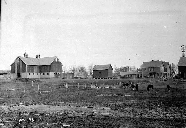
 Researchers may be interested in uncovering what the land looked like when it was originally surveyed, and compare this against what the land looks like today.
Family farm researchers can get a sense of what the land looked like prior to ownership via the Land Survey Notes found on the Bureau of Land Management website. These notes describe in detail various features of the land (vegetation, Indian burial mounds, trails, etc. ) at the time it was surveyed.
To get a sense for what the farmland looks like today, and uncover how the land is currently being used, you can utilize aerial photography. Certain counties have developed aerial surveys of land within county boundaries. Contact each county individually to access. Additional aerial photographs from MNHS collections can be accessed via this link. Google Earth can also be utilized to view land in its current state.
County atlases and topographic maps not only show who owned land previously, but they also reveal the changes in the natural features of the land over time. Topographic maps illustrate water bodies, streams, forest cover, and built areas. These maps come together in series, at different scales and extents, and are published by the United States Geological Survey. They contain information about the physical lay of the land and such cultural features as individual farms, small villages and towns, rural churches and cemetery locations.
Accessing Topographic Maps:
Historical Topographic Map Collection is an online resource that captures all editions of the more than 193,000 topographic maps published by the USGS since the inception of the topographic mapping program in 1884.
The U.S. Geological Survey Topographic Maps is an online resource with an extensive collection of topographic maps in electronic form.
Minnesota: Index to Topographic and Other Map Coverage, Geological Survey (U.S.). The Survey, [1991].
Lists the various series of maps produced and distributed by the USGS.
MNHS call number: U.S. Docs I 19.41/6-3 : M 66/991
Search the library catalog with the subject keyword "topographic maps" or with the Geological Survey (U.S.) as an author.
Land patent documents:
The legal transfer of parcels of land from the U.S. Government to individuals. A patent will include the date, legal description of land, patent number, and office that issued the patent.
Deed and Mortgage Books:
A deed is a document providing evidence of ownership. Mortgage books list the value of the property. They also provide you with a timeline for the construction of property on the land (i.e. mortgages will begin to be paid when a house or other structure is added to the property).

Gale Family Library
Minnesota Historical Society Library
Located on the Second Floor of the Minnesota History Center
345 West Kellogg Blvd.
St. Paul, MN 55102
Library Hours:
Thursday to Saturday: 10am to 4pm
Sunday to Wednesday: Closed
More Information on Visiting the Library
Contact Us:
651-259-3300